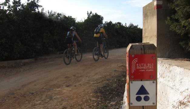
The Ruta de los Monasterios de Valencia (Monasteries of Valencia Route) (Sendero de Gran Recorrido GR-236) (Long-Distance Path GR-236)), is a historic and religious path of medieval origin that was recovered and signalled to be travelled by foot, bicycle, on horseback or by car. This route connects five Valencian monasteries: Santa María de la Murta in Alzira, la Valldigna in Simat, Aigües Vives in La Barraca (Alzira), Sant Jeroni de Cotalba in Alfauir and the Santo Domingo Convent in Llutxent.
When constructing the route, old mountain paths, roads and Royal Cattle Tracks were recovered. This is where the poor travelled from monastery to monastery, in search of food and shelter. For trekkers, the route begins in the city of Gandía and comes to an end in Alzira, penetrating the Valencian regions of Safor, Vall d'Albaida and the Ribera Alta. The Monasteries Route for mountain bikers begins and ends in the city of Alzira. It is 142 km long, and there is specific mountain biking signalling along the entire route.
This route goes through a total of 22 municipalities, including Xeresa, Xeraco and Tavernes de Valldigna, at sites not crossed by the trekking path.
A route of medieval origin through monasteries from the Hieronymite, Augustine, Dominican and Cistercian orders, in three regions: Safor, Vall d'Albaida and the Ribera Alta.
The mountain bike route is 142 km long, and begins in the city of Alzira. It is circular.
The Monasteries Route has recovered old medieval paths, such as the Paso del Pobre, livestock trails, rural roads and old abandoned railway tracks.


